US Time Zones Explained: The Nine Zones, Who Sets Them and Where the Lines Run
Federal law sets nine U.S. time zones, from Coordinated Universal Time (UTC) minus 4 hours to plus 10. See who draws the lines and which states they cross.

Published 6 min read

Key dates
In this article
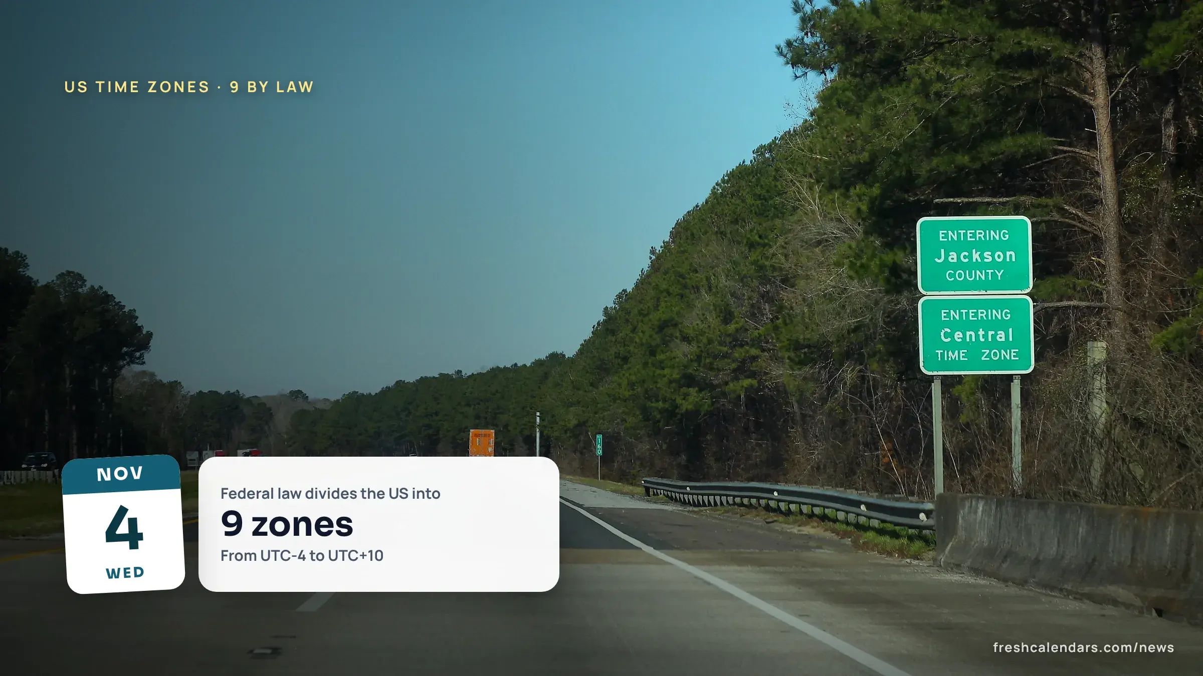
Federal law divides the United States into nine time zones: 15 U.S.C. 261 sets their standard times from Coordinated Universal Time (UTC) retarded by 4 hours (Atlantic) to UTC advanced by 10 hours (Chamorro). The zones are named in 15 U.S.C. 263, and their limits are defined by an order of the Secretary of Transportation, printed in 49 Code of Federal Regulations (CFR) Part 71. Below: a table of all nine zones with the time in each when it is noon in the Eastern zone, the 13 states whose zone lines run inside them, and a one-page card to print.
How many time zones does the US have?
Nine, by statute. The United States Code (U.S.C.) says that “for the purpose of establishing the standard time of the United States, the territory of the United States shall be divided into nine zones.” The law numbers them, and the number of each zone is its offset from UTC: the first zone is UTC “retarded by 4 hours,” the second 5, the third 6, the fourth 7, the fifth 8, the sixth 9, the seventh 10 and the eighth 11. The ninth is the only one ahead of UTC: “Coordinated Universal Time advanced by 10 hours.”
Section 263 gives the names in the same order: Atlantic, eastern, central, mountain, Pacific, Alaska, Hawaii-Aleutian, Samoa and, for the ninth, “known as Chamorro standard time.”
The nine US time zones in one table
The first four columns come from 15 U.S.C. 261 and 263 and from 49 CFR Part 71. The last two are our arithmetic: the daylight saving time (DST) column adds the one hour that 15 U.S.C. 260a(a) says standard time “shall be advanced,” and the noon column counts the hours from the Eastern zone’s standard time of UTC-5.
| Zone (law’s number) | Standard time | Offset from UTC | During DST, where observed | When it is 12 noon in the Eastern zone, standard time | Places |
|---|---|---|---|---|---|
| 1 Atlantic | Atlantic standard time | UTC-4 | UTC-3 | 1 p.m. | Puerto Rico (49 CFR 71.3), U.S. Virgin Islands |
| 2 Eastern | Eastern standard time | UTC-5 | UTC-4 | 12 noon | East of the line in 71.5, and all of Maine (71.4) |
| 3 Central | Central standard time | UTC-6 | UTC-5 | 11 a.m. | Between the lines in 71.5 and 71.7 (71.6) |
| 4 Mountain | Mountain standard time | UTC-7 | UTC-6 | 10 a.m. | Between the lines in 71.7 and 71.9 (71.8) |
| 5 Pacific | Pacific standard time | UTC-8 | UTC-7 | 9 a.m. | West of the line in 71.9, in the continental United States, but no part of Alaska (71.10) |
| 6 Alaska | Alaska standard time | UTC-9 | UTC-8 | 8 a.m. | The entire State of Alaska except the Aleutian Islands west of 169 degrees 30 minutes west longitude (71.11) |
| 7 Hawaii-Aleutian | Hawaii-Aleutian standard time | UTC-10 | UTC-9 | 7 a.m. | All of Hawaii and the western Aleutian Islands (71.12) |
| 8 Samoa | Samoa standard time | UTC-11 | UTC-10 | 6 a.m. | The area between 169 degrees 30 minutes and 172 degrees 30 minutes west longitude, which includes American Samoa (71.13) |
| 9 Chamorro | Chamorro standard time | UTC+10 | UTC+11 | 3 a.m. the next day | Guam and the Northern Mariana Islands (71.14) |
The noon column is for standard time. If one place advances its clocks and another stays on standard time, the gap between them changes by an hour.
Who sets US time zones, and who enforces them?
Two branches share the job. Congress fixes the number of zones and their offsets in 15 U.S.C. 261. The same section hands the map to the executive branch: “The limits of each zone shall be defined by an order of the Secretary of Transportation, having regard for the convenience of commerce and the existing junction points and division points of common carriers engaged in interstate or foreign commerce.” That order is 49 CFR Part 71. Its history notes cite amendments through 78 Federal Register (FR) 15884, dated March 13, 2013.
The Uniform Time Act of 1966 adds a mandate, in 15 U.S.C. 260: the Secretary of Transportation is directed to “promote widespread and uniform adoption and observance of the same standard of time within and throughout each such standard time zone.” The Department of Transportation (DOT) website was not readable by our tools, so this story does not describe how a zone change is requested; only the statute and the regulation text are quoted.
Which states are split between time zones?
Part 71 describes each boundary as a path: county lines, rivers, state lines and in one case a city line. The table lists the states where that text follows a line inside the state, with the section and what it names. Several other states border a zone line only along their edges, such as Georgia and Alabama in section 71.5(e).
| State | Section | Boundary | What the text names |
|---|---|---|---|
| Michigan | 71.5(a) | Eastern and central | The state’s western boundary, and the lines of Gogebic, Ontonagon, Iron, Dickinson and Menominee counties |
| Indiana | 71.5(b) | Eastern and central | County lines, including LaPorte, Starke, Marshall, Pulaski, Jasper, Newton, Gibson, Pike, Warrick, Spencer and Perry |
| Kentucky | 71.5(c) | Eastern and central | County lines, among them Meade, Hardin, Larue, Taylor, Casey, Pulaski and Wayne |
| Tennessee | 71.5(d) | Eastern and central | The lines of Scott, Morgan, Roane, Rhea and Hamilton counties |
| Florida | 71.5(f) | Eastern and central | “along the middle of the main channel of the Apalachicola River,” then the Jackson River, the Intracoastal Waterway and the west line of Gulf County |
| North Dakota | 71.7(a) | Central and mountain | The Missouri, Yellowstone and Little Missouri rivers and lines in Mercer, Morton and Sioux counties |
| South Dakota | 71.7(b) | Central and mountain | The Missouri River near Pierre and the lines of Jones, Mellette and Todd counties |
| Nebraska | 71.7(c) | Central and mountain | The South Dakota-Nebraska boundary, section and range lines and county lines |
| Kansas | 71.7(d) | Central and mountain | The Kansas-Colorado boundary and the lines of Sherman, Logan, Wallace, Wichita, Greeley and Hamilton counties |
| Texas | 71.7(e) | Central and mountain | “the east line of Hudspeth County, Tex.” down to the Mexican border |
| Idaho | 71.9(a) | Mountain and Pacific | “westerly along the main channel of the Salmon River to the Idaho-Oregon boundary” |
| Oregon | 71.9(a) | Mountain and Pacific | The north and west lines of Malheur County |
| Nevada | 71.9(b) | Mountain and Pacific | The boundaries of the City of West Wendover |
Section 71.5(h) puts all municipalities on the eastern and central line in the central zone. Sections 71.7(g) and 71.9(d) put those on the other two lines in the mountain zone, with one exception in 71.7(g): Murdo, South Dakota, is in the central zone. Alaska has two zones as well, because Part 71 puts the Aleutian Islands west of 169 degrees 30 minutes west longitude in Hawaii-Aleutian.
Do all US time zones change their clocks?
The law sets the default. During the period “commencing at 2 o’clock antemeridian on the second Sunday of March” and “ending at 2 o’clock antemeridian on the first Sunday of November,” each zone’s standard time is advanced one hour (15 U.S.C. 260a(a)). The law allows two exemptions: a state that lies entirely within one zone “may by law exempt itself,” provided the whole state keeps standard time, and a state with parts in more than one zone may exempt either the entire state or “the entire area of the State lying within any time zone.” This story does not list which states have exempted themselves, because no official list was confirmed.
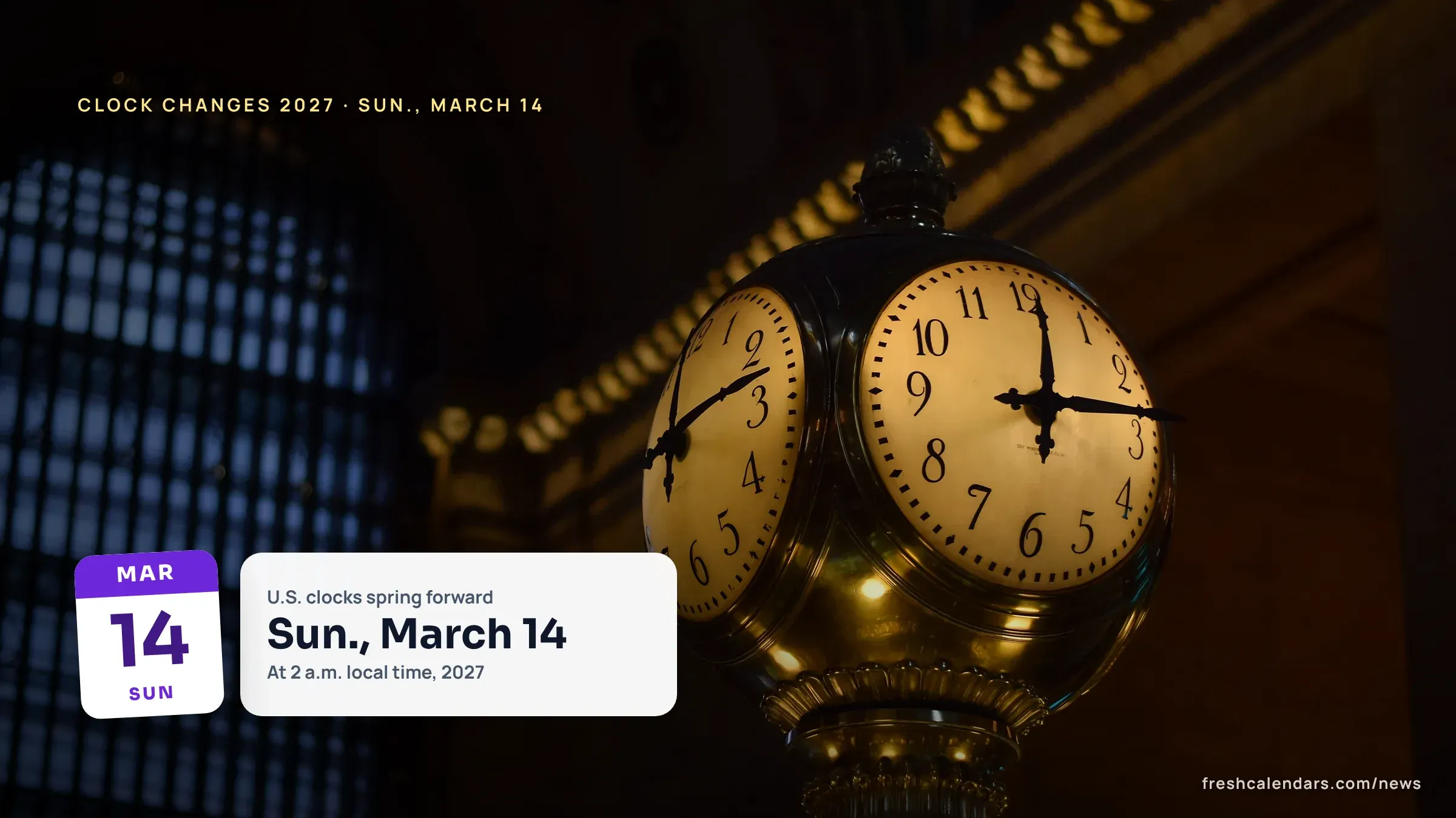
The National Institute of Standards and Technology (NIST) says at time.gov that “the change to Standard Time occurs at 2 a.m. (local time) on Sunday 11/01/2026.” Under the rule in 260a, the next advance falls on Sunday, March 14, 2027, and the next return to standard time on Sunday, Nov. 7, 2027; those two dates are our computation from the statute, not a published DOT notice. Our daylight saving time page tracks the date, and the 2027 clock changes story covers it in detail. The November 1 change is already past.
Print the nine-zone card
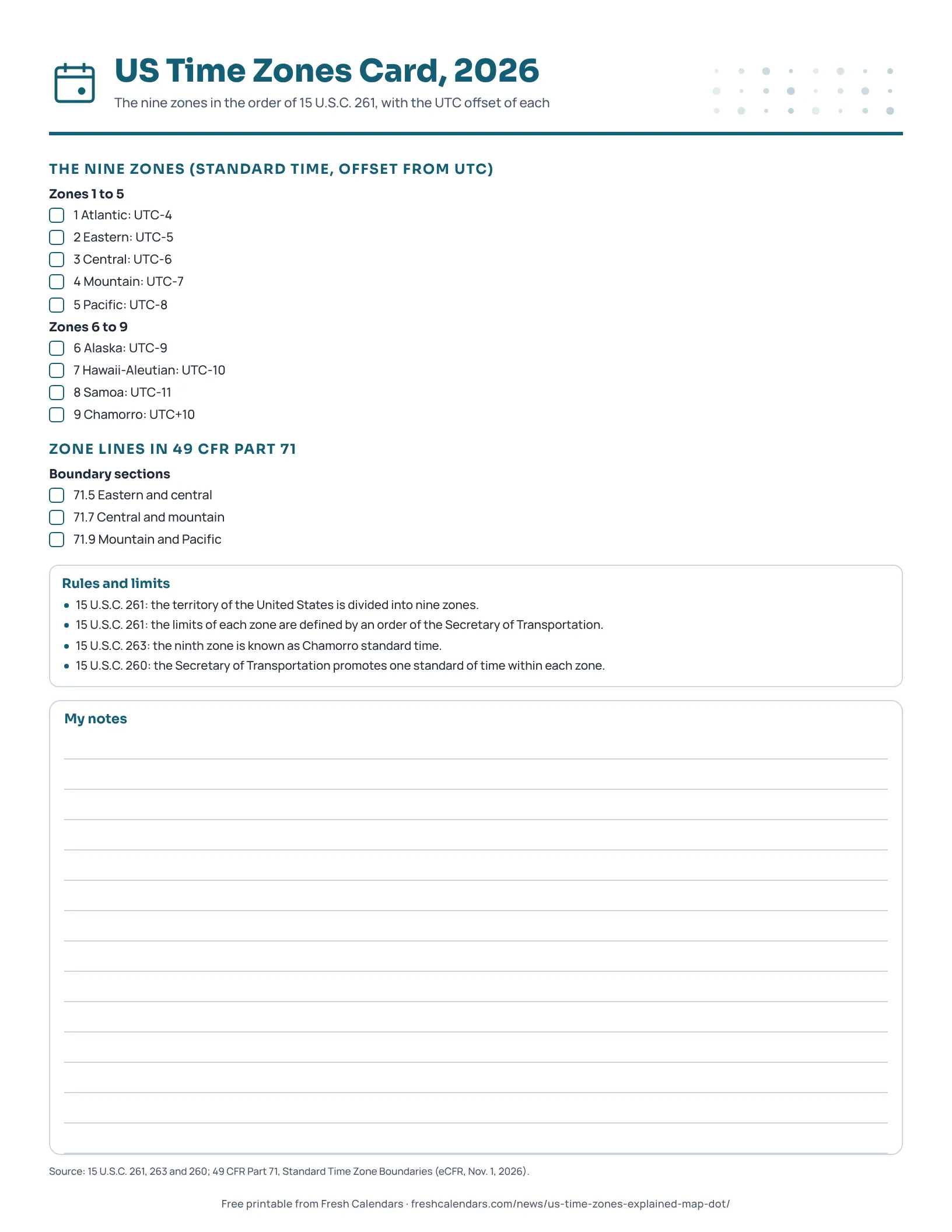
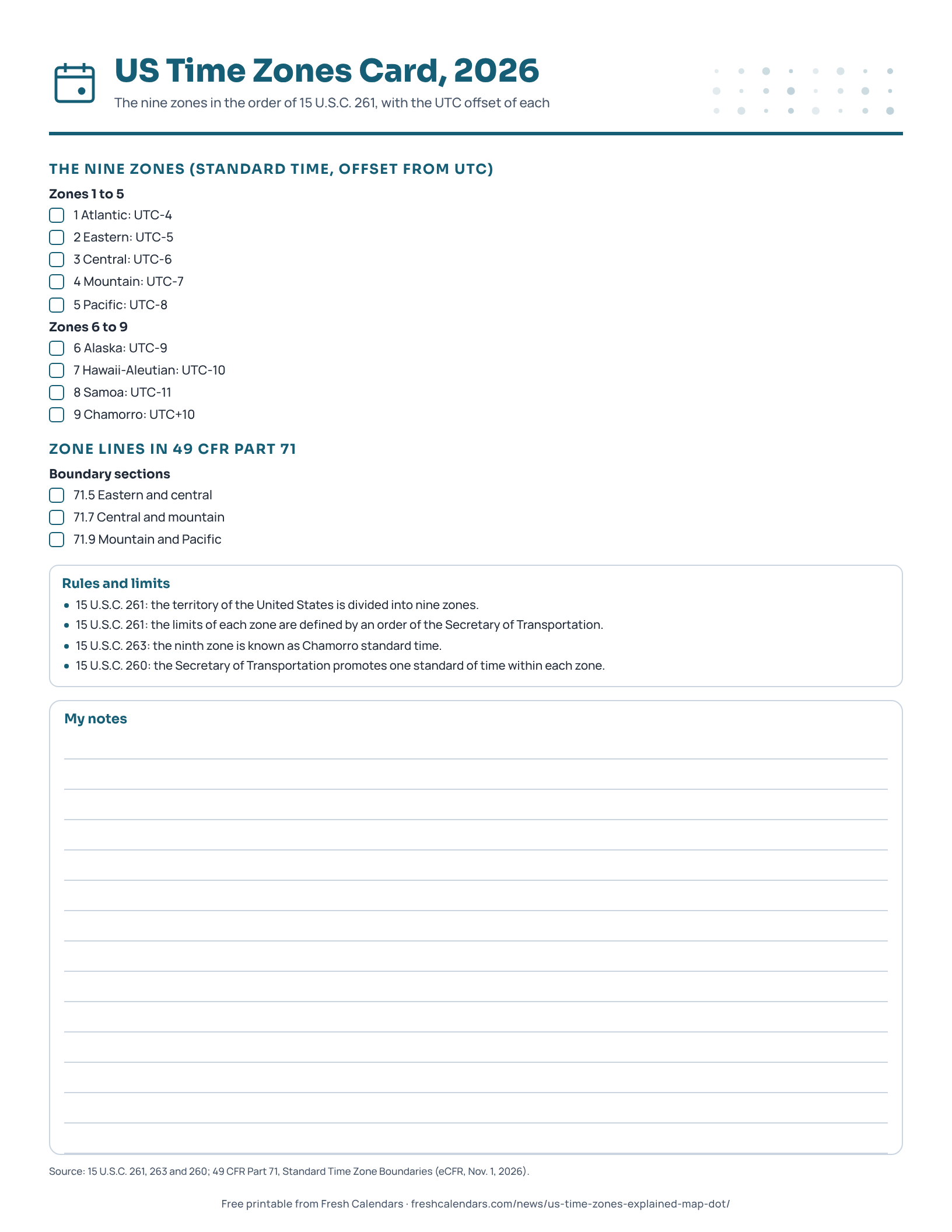
The one-page US Time Zones Card, linked below this story, lists the nine zones in the law’s order with their UTC offsets, the three boundary sections of Part 71 and four rules quoted from the statutes. Pair it with a 2027 printable yearly calendar to mark the March 14 and Nov. 7, 2027 changes. For how the zones line up at the turn of the year, see the midnight countdown for every time zone.
Free printable downloads
Every template is free, needs no sign-up and prints on US Letter paper. Choose PDF for printing or PNG for screens and documents.
US Time Zones Card printables
-
US Time Zones Card, 2026
A one-page card of the nine U.S. time zones in the order of federal law, with each zone's offset from UTC and the three boundary sections of 49 CFR Part 71.
Frequently asked questions
How many time zones are in the US?
Nine by law. 15 U.S.C. 261 says the territory of the United States shall be divided into nine zones, and 15 U.S.C. 263 names them Atlantic, eastern, central, mountain, Pacific, Alaska, Hawaii-Aleutian, Samoa and Chamorro.
Which states have two time zones?
The boundary text in 49 CFR Part 71 runs through counties, rivers or a city line in Michigan, Indiana, Kentucky, Tennessee, Florida, North Dakota, South Dakota, Nebraska, Kansas, Texas, Idaho, Oregon and Nevada. Alaska also has two: Part 71 puts the Aleutian Islands west of 169 degrees 30 minutes west longitude in Hawaii-Aleutian.
Who decides which time zone a place is in?
Congress sets the number of zones and their offsets from UTC in 15 U.S.C. 261. The same section says the limits of each zone are defined by an order of the Secretary of Transportation, and that order is 49 CFR Part 71.
Does every state change its clocks?
No. 15 U.S.C. 260a lets a state that lies entirely within one zone exempt itself by law, and a state in more than one zone may exempt the entire area lying within any one zone.
Sources
- 15 U.S.C. 261: Standard time zones (Office of the Law Revision Counsel, U.S. House of Representatives)
- 15 U.S.C. 263: Designation of zone standard time (Legal Information Institute, Cornell Law School (United States Code))
- 15 U.S.C. 260: Congressional statement of policy; Uniform Time Act of 1966 (Legal Information Institute, Cornell Law School (United States Code))
- 15 U.S.C. 260a: Advancement of time or changeover dates (Legal Information Institute, Cornell Law School (United States Code))
- 49 CFR Part 71: Standard Time Zone Boundaries (Electronic Code of Federal Regulations (eCFR), 2026-11-01)
- time.gov (National Institute of Standards and Technology (NIST))
Related news
-
 New Year’s Countdown 2027: When Midnight Arrives in Every Time Zone
-
 Clock Changes 2027: When Daylight Saving Time Starts Again on March 14 in the U.S., UK, Europe and Australia
-
 Daylight Saving Time Ended Nov. 1, 2026: Clocks Fell Back While the Permanent-DST Bill Waits in the Senate
-
 The Year 2038 Problem: Why Some 32-Bit Clocks Run Out on Jan. 19, 2038
More in Calendar Guides
All Calendar Guides stories →- Seasons 2027: First Day of Spring, Summer, Fall and Winter With Exact Times
- UK Tax Year 2027-28: Starts 6 April 2027, and the Key HMRC Dates
- UTC vs GMT: What the Difference Is and Which One Your Clock Uses
- 24-Hour Time Conversion Chart: Military Time to a.m. and p.m., Printable
- How Many Fridays Are in 2027? 53, With Every Weekday and Weekend Count
Trending now
- November 2026 Meteor Showers: Taurid Fireballs Under Dark Skies, Then the Leonids on Nov. 16-17
- Black Friday Canada 2026: Nov. 27 Date, Canadian Tire Deals From Nov. 5, Who Hasn't Announced
- SNAP Payment Schedule November 2026: Deposit Dates for Every State, With Weekend Days Flagged
- Black Friday 2026 Deals: Date Is Friday, Nov. 27, Live Countdown and Ad Tracker
- Veterans Day Free Meals 2026: 44 Chains Confirmed, 13 Discounts and a Printable List